Authors: Esther Judith Otieno, Caleb Cheruiyot, Francis Onyambu, Dancan Owaga, Caroline Kabaria
Cities across Africa face a range of environmental pressures from flooding and waste management challenges to water scarcity and climate risks.
What if the data already being collected every day could reveal accurately, where environmental risks are highest, where services are missing, and where interventions would have the greatest impact?
Kisumu City in Kenya continues to experience growing environment and urban management pressures with expanding waste streams, changing climate risks, increasing demand for water services, and inadequate coordinated planning across sectors. While officers collect large amounts of data through fieldwork and existing reporting processes, much of this data remains underutilized because it is not mapped or presented in formats that enable effective policy and planning decisions.
A needs assessment conducted among Kisumu county environment management staff in November 2025 revealed a clear opportunity. A majority of staff have knowledge of Geographic Information Systems (GIS), but few felt confident applying it independently in their work. Consequently, nearly all participants believed GIS could significantly improve planning, monitoring, and reporting.
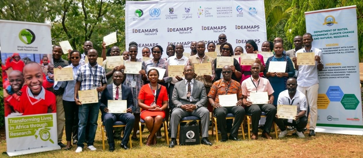
The Population Dynamics and Urbanization research theme at the African Population and Health Research Center (APHRC), organized a four-day GIS capacity-strengthening training as a practical step toward data-driven environment management.
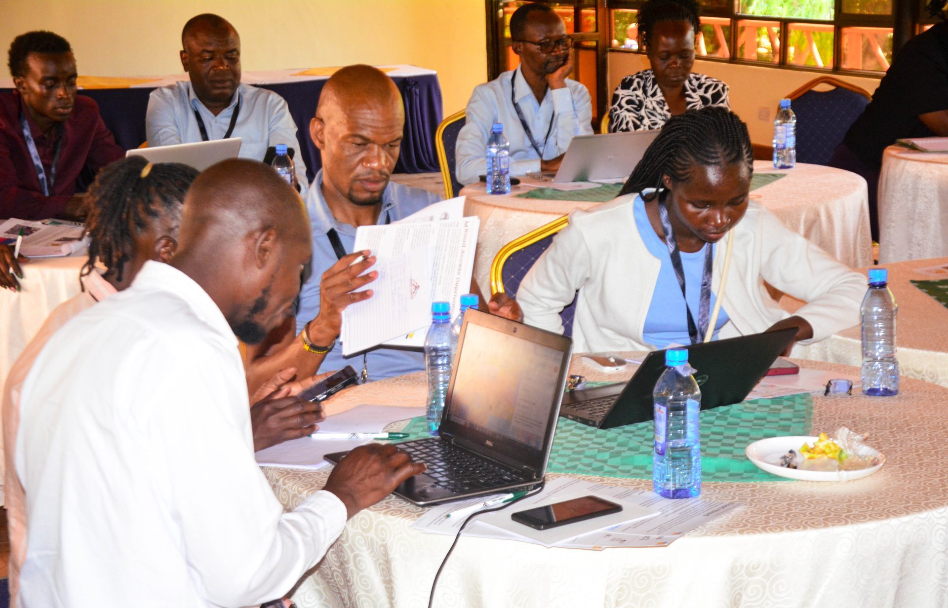
The training on GIS for environment management was attended by 28 staff within the environment and related departments in Kisumu city. The training focused on hands-on learning where participants were introduced to GIS fundamentals; understanding how location-based data can reveal patterns invisible in spreadsheets and reports. Laptops replaced notebooks as participants began designing their own digital data collection forms using KoboToolbox. For many, this was the first time seeing how field data tools were designed and could automatically capture geographic details thus transforming routine inspections into information on a map.
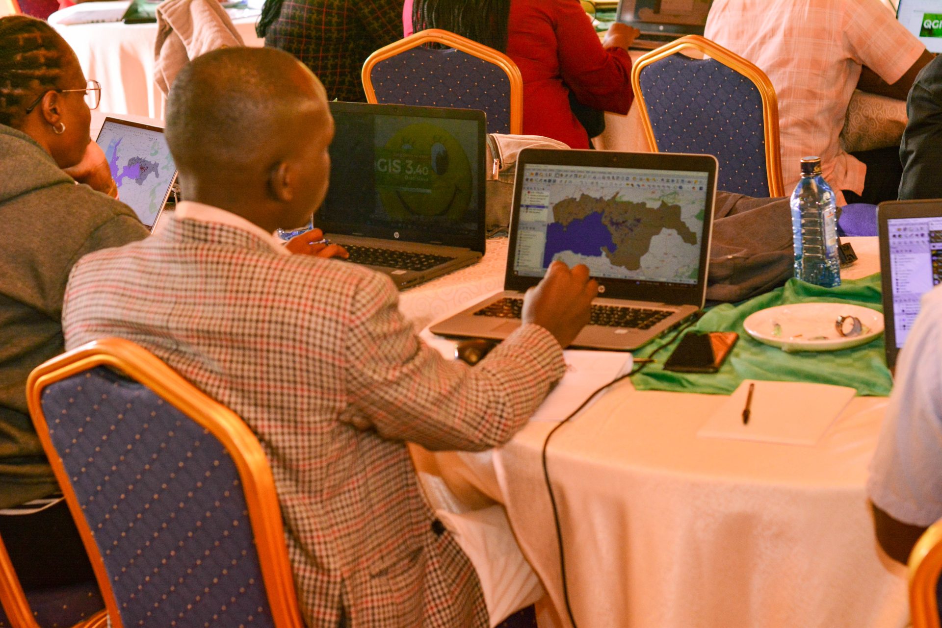
By the second day, participants were navigating QGIS, an open-source GIS platform. What initially felt technical quickly became practical. Participants learnt how to clean datasets in Excel, join tabular information to spatial layers, and create choropleth maps that show patterns such as service coverage and environment hotspots. Routing analysis exercises using the openrouteservice plugin demonstrated how GIS could optimize waste collection routes, service areas and identify underserved communities.
One participant remarked:
“I have gained a wide array of knowledge and new skill sets in GIS using a variety of tools and platforms, such as QGIS and the “Kobo toolbox”, amongst others.”
The room often shifted between focused silence, moments of excitement as maps appeared on screens showcasing visual representations of challenges and discussions on how the skills gained can be used daily in their work.
Outputs/impact- possible areas of use identified
What made the training particularly impactful was its grounding in real departmental needs and use cases. Environment officers explored mapping waste hotspots and monitoring compliance sites. Water officers examined how GIS could support planning of water infrastructure and identify underserved areas. The climate change team discussed mapping flood and heat risk zones, while public health officers envisioned tracking sanitation coverage and disease hotspots.
Rather than learning software alone, participants were learning new ways of thinking about their work. Participants were able to produce complete maps; from data collection to visualization, and exporting them for reports and presentations. Datawrapper software further demonstrated how simply spatial insights could be communicated clearly to decision-makers and communities.
More than skills: Building confidence
The post-training evaluation reflected improved confidence among participants in managing spatial data, creating maps, and applying GIS tools within their departments. GIS was no longer seen as a specialized tool reserved for experts, but as an accessible and important tool that officers could integrate into routine workflows.
Many participants expressed eagerness to immediately apply their new skills to:
- Mapping waste collection and illegal dumping sites
- Monitoring environmental compliance
- Tracking water infrastructure projects
- Assessing climate risks
- Supporting planning and reporting processes
The four days sparked transformation, however, continued learning is essential. Several participants recommended a follow-up training to deepen analytical skills and support sustained application. The training also highlighted the importance of open-source tools. By using freely available platforms such as QGIS and KoboToolbox, participants continue practicing and applying GIS without licensing barriers which is a critical factor for long-term sustainability.
Way forward-collaborations
Capacity strengthening is not a single event but a process. This training marked an important step toward embedding spatial thinking within county operations. As participants return to their departments, the data they collect, the maps they create and spatial analysis done, have the potential to improve coordination, strengthen planning, and support more responsive environmental management across Kisumu City.
Ultimately, the training demonstrated a simple but powerful idea:When data is mapped, it becomes visible.When it becomes visible, it becomes actionable and better decisions follow.